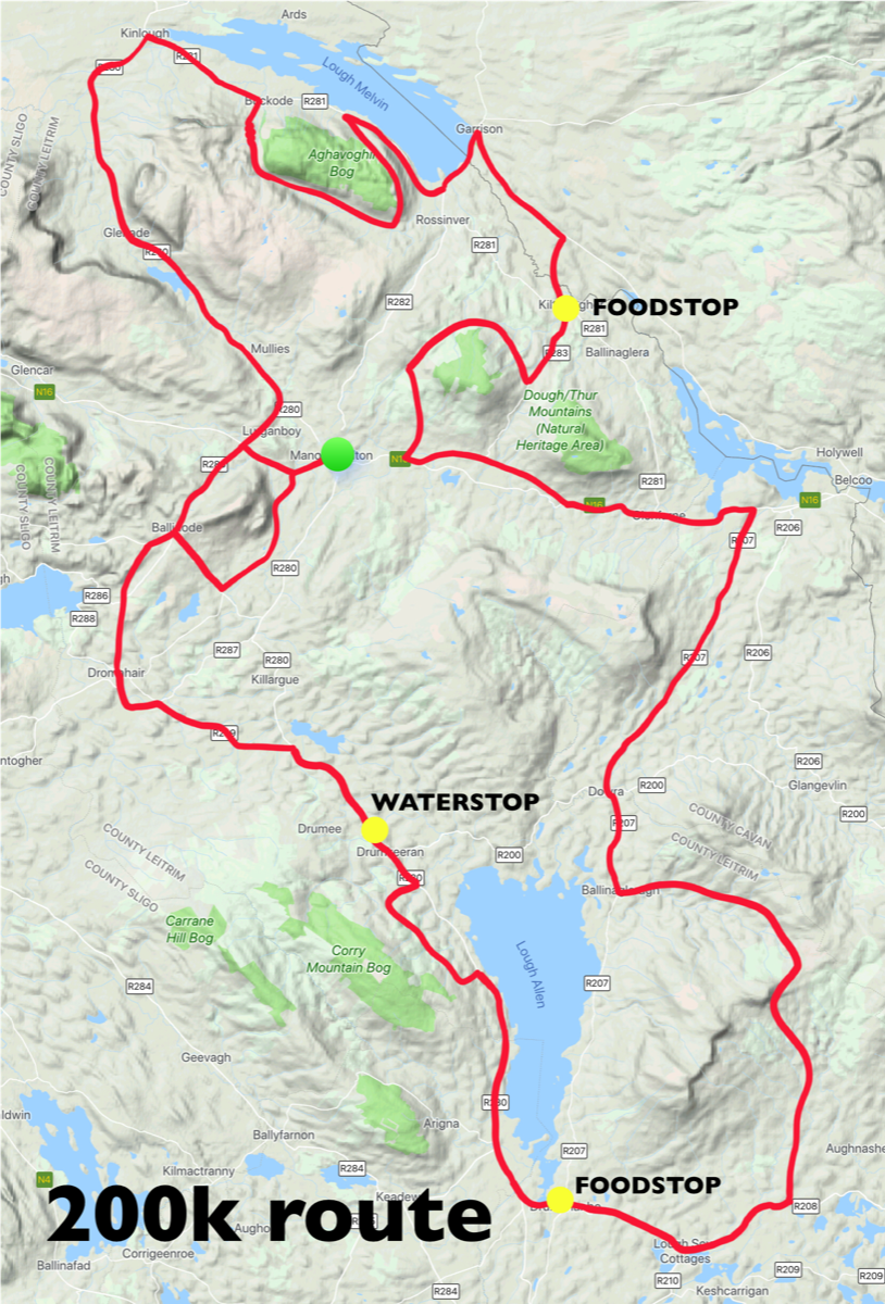
200km Route
This route is similar to the Wicklow 200 and is designed for experienced cyclists who are fully competent on technical descents and have excellent overall bike skills.
This year we are happy to announce that the 200km has been radically changed to make it almost entirely in County Leitrim. This reflects the support the event has received from Leitrim Development Company and Leitrim County Council. We have a new 12km climb up Bencroy averaging 3% on the east side of Lough Allen and on the west side we have Tarmon Climb which averages 4% over 7km.
The 200km route follows the map in a clockwise direction. There are nine categorised climbs which are described below. The route summary is Manorhamilton - Kilcoosey Climb - Moreagh Descent - Lurganboy - Kinlough - Glenaniff Climb - Barr Road Climb (S-N) - Garrison - Kiltyclogher (Food Stop) - Killea Climb - Glenfarne - Dowra - Ballinagleragh - Bencroy Climb - Drumshanbo (Food Stop) - Tarmon Windmills Climb - Drumkeerin (Food Stop) - Dromahair - Newtownmanor Climb - Moreagh Descent - Manorhamilton. Total elevation gain is 2,700m.
Kilcoosey Climb 2.3km 143m 6.1%
The first climb of the day starts gently enough, but by the second kilometre it starts to kick up above 12% in several sections. At the end of the climb you descend Moreagh, climb a short hill into Lurganboy and head on for Kinlough through Glenade Valley.
Lurganboy Climb 1km 40m 4%
This is a short sharp climb just off the N16 where you should be careful not to lose the wheel. After the descent there is a long rolling section before the big climb to come.
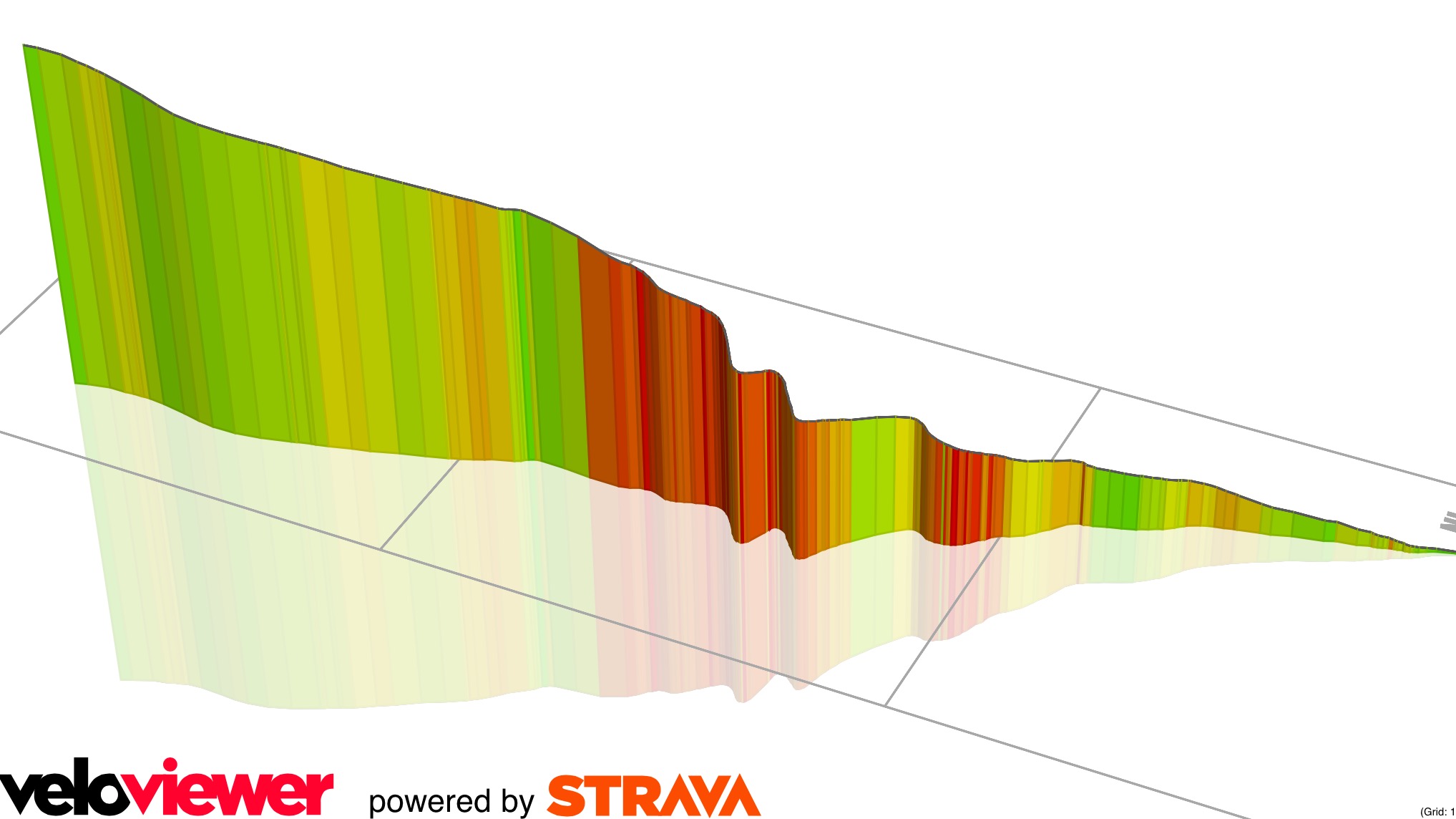
Glenaniff Climb 2.9km 229m 7.8%
This is the big one. Once you are over Glenaniff you know you have cracked it. The start and end are moderate but in the middle section there are 4 switchbacks as the gradient reaches up over 20% on the corners. Focus on the mobile phone mast you see as you start the climb - once you have reached the mast the worst is over.
Barr Climb (S-N) 3.1km 129m 3.6%
The words “The Barr Climb” usually strike fear into local cyclists, but here we are tackling the easier southern side. We are already at altitude so despite two or three steep bits this is fairly easy. Enjoy panoramic views of Lough Melvin as you crest the summit and take care on the tricky descent, which has a few sharp turns, the possibility of light gravel and a sudden exit on to the lakeside road.
Kilty Braes & Killea 8.8km 317m 2.9%
After leaving Kilty there are two short steep sections on the main road. After the right turn you are on a very minor road called Killea. This is one of the climbs that is perhaps more difficult than it looks. Take care on the steep descent through Ballyboy and the exit onto the N16.
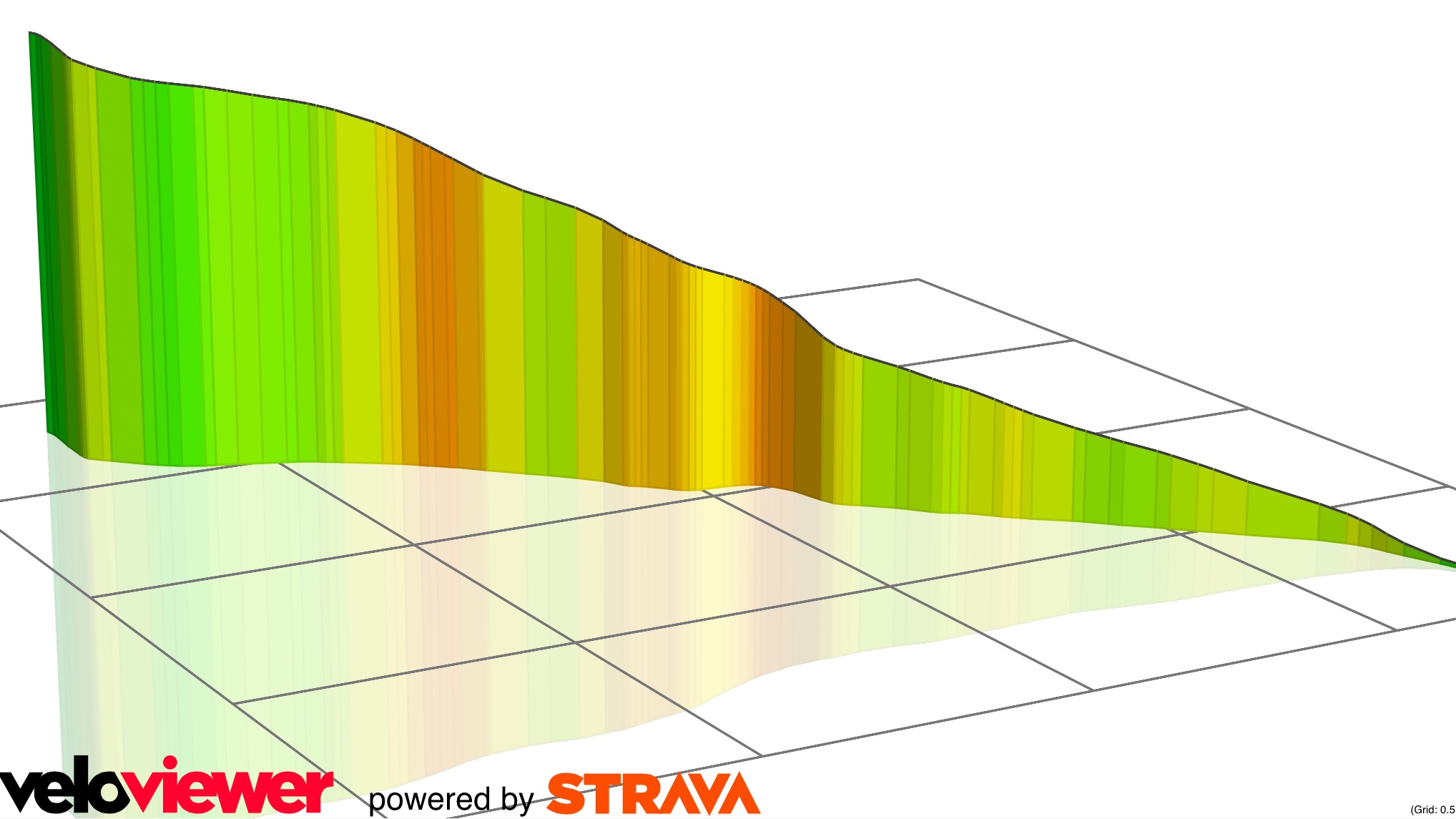
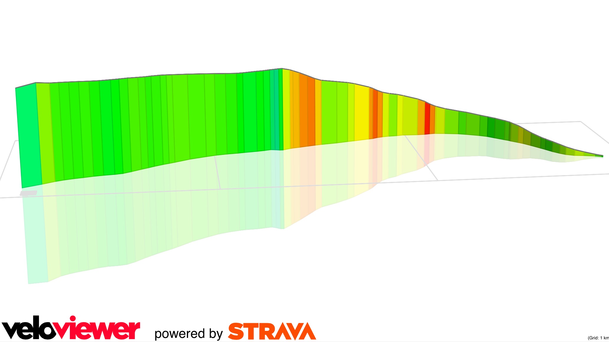
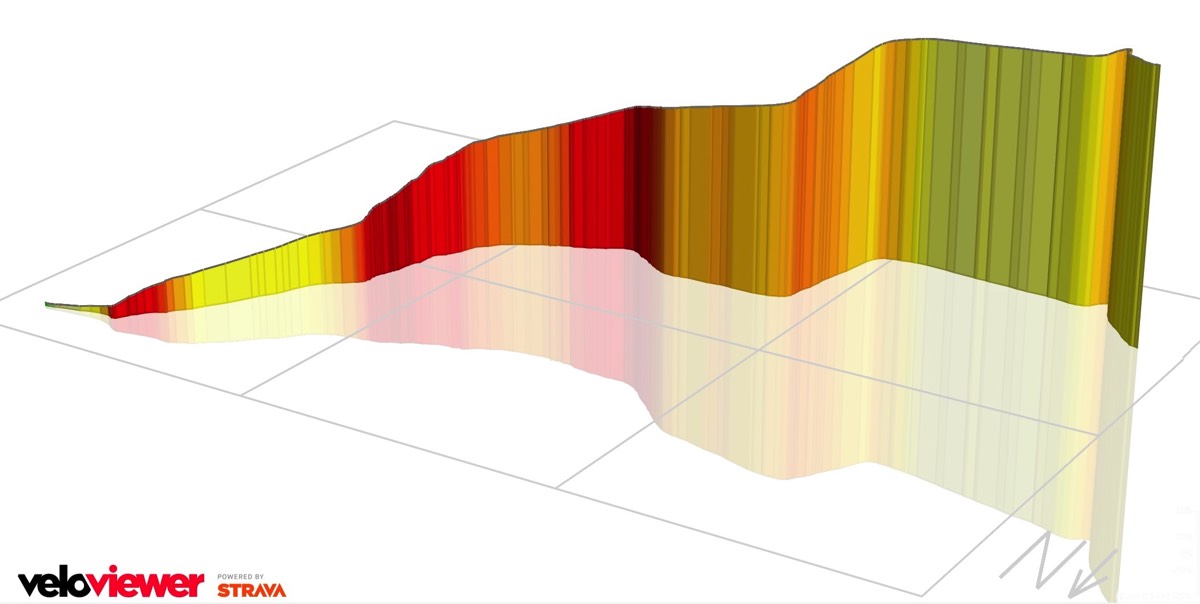
Bencroy 12km 420m 3%
Bencroy is a long steady climb over 12km and at 420m has the most elevation gain of all the climbs in the sportive. As you get deeper into the wilderness you'll see several mobile phone masts which mark the summit and pass a monument to the Ultachs who once lived here. Take care on the steep descent which has a slight chicane at a bridge on the way to Aghacashel.
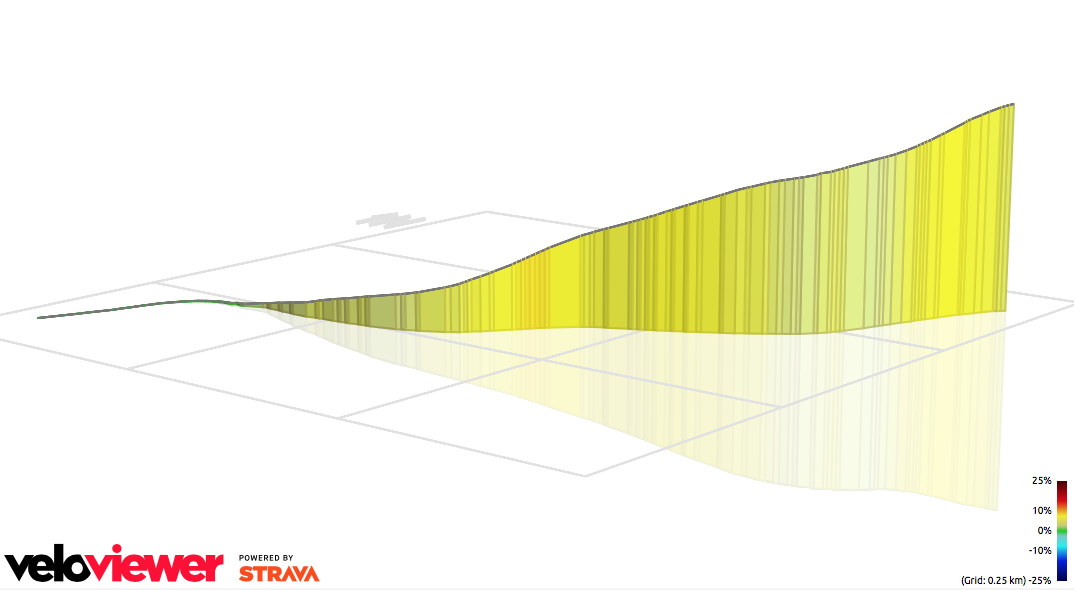
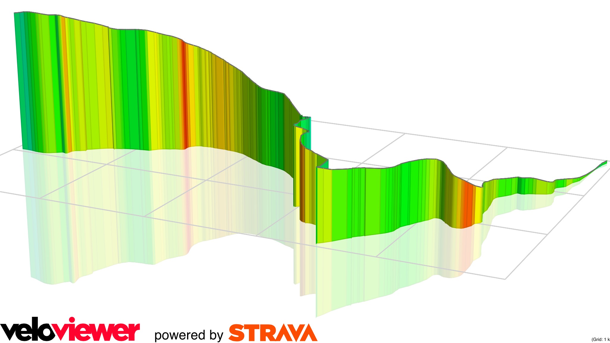
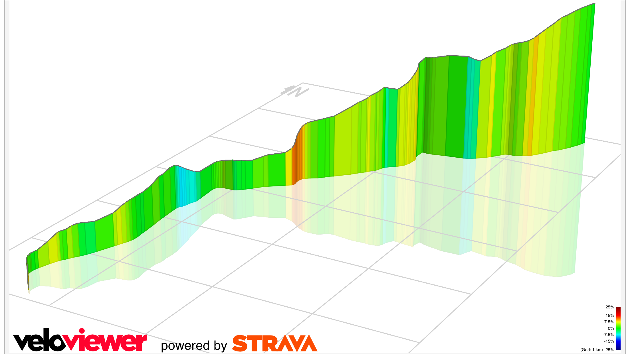
Tarmon Climb 7km 205m
This climb starts near the church in Tarmon. The profile shows the first 5km of the climb which features several steep challenging ramps for which you might need a 34-32 ring for comfort. There are stunning views out over Lough Allen from the long plateau at the top of the climb. Take care on the Barragh More descent past the Dogs Home.
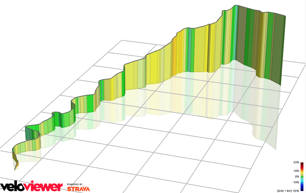
Newtownmanor Climb 7.4km 191m 2.6%
The climb up Newtownmanor also has a few surprises. On leaving Dromahair you turn right and climb up to the road that passes Newtownmanor church. Just here the road kicks up over 10% for a short time and presents a few tricky ramps. This is the first 80% of the profile map.

Benbo 1.7km 3% 200m
The last 20% of the profile is the final climb of the day up the back of Benbo mountain. From the summit you can enjoy the sharp descent to Shanvas and on to the finish where a hot meal awaits you.
Profile Colour Guide
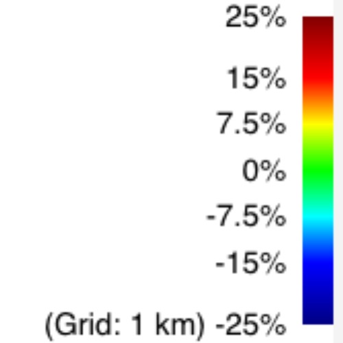
All the profile maps above are provided courtesy of VeloViewer, powered by data from Strava. The different shades of green refer to gradients up to around 5%. Yellow is for 6-8%, Orange for 9-11% and Red for anything over 12%.